Saturday, July 26, 2014

Drive Through Museum

World's First Drive through Museum
Green Family Vacation 2014: Panama City Beach

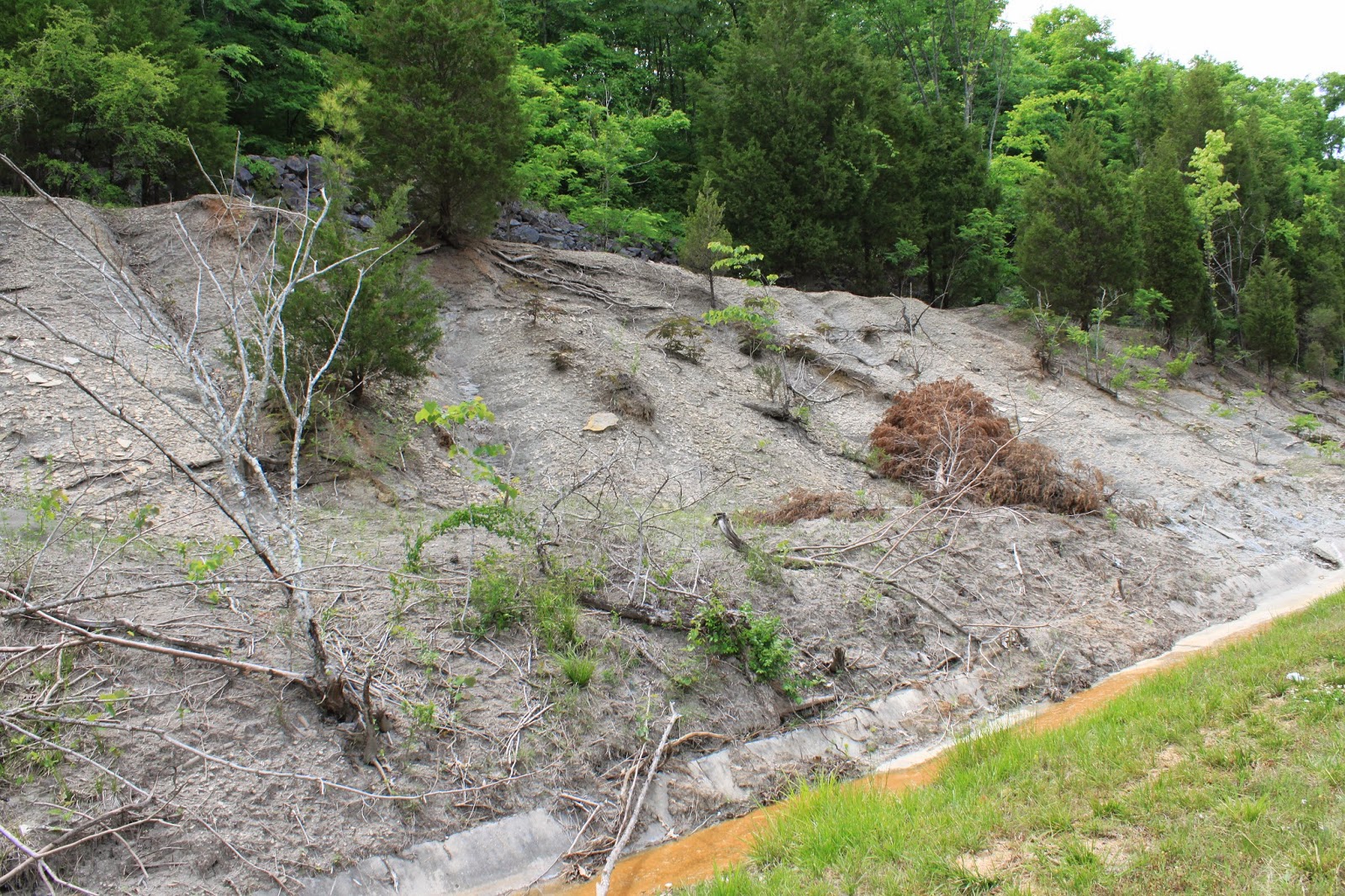
Headed south on US 431 I found a geocache at this locality north of Seale in Russell County, Alabama. One of the oddest places I have ever seen.

Wednesday, July 9, 2014

Grave of George Disney


Date of Visit: July 5, 2014

Location:
Dalton, Whitfield, Georgia
Lat            34.644501      
Long              -84.389847


This grave is located near the end of the George Disney Trail in Dalton, Georgia. This trail ascends Rocky Face Mountain to a location referred to as Buzzard Roost. The trailhead for this trail is behind the State Trooper Post on Highway 41. This is an awesome hiking trail. It is also step in some places. My GPS had the altitude in the parking lot as 913 feet above sea level. The grave is at 1492 feet. I am not sure of the distance of the hike. We missed the grave going up and we hiked quite a ways out Rocky Face Ridge.  We were very tired when we returned to the truck.

Inscription:
In Memory of George Disney
Co K 4 KY Inft
Killed
Feb 24 1864
Erected By
Dalton Boy Scouts
1912

George’s Story was well documented in 1898 by Ed Thomson Porter in The History of the Orphan Brigade. The following is taken verbatim from pages 238 and 239

A Singular Death.

In February, 1864, Rocky Face Ridge was occupied by Johnston as a signal station. The Fourth Kentucky was so deployed as to form a living telegraph line from the valley next
to Dalton to the top and front face of the Ridge at a point where, next to the Federals, the ascent was perpendicular. From the top of this ridge the Federal army was in full view. The next day after the formation of this line, there was a collision of the Federal and Confederate forces on the right of our line, and when the Federals would move, word was passed from man to man of the living telegraph, as, " Two more brigades advancing on such and such a point." The first night after the formation of the telegraph, the men slept at their posts. The next morning George Disney, a private of Company B, arose to a sitting posture, after a nights sleep on the top of this height in the open air, and was in the act of gaping, as many men are wont to do on first awaking. He was seen suddenly to resume his recumbent position, as though resolved to take another nap ; but after he hadbeen so lying for an hour or two, men who tried to wake him found that life had departed. A careful examination at the time disclosed no wound, and it was conjectured that he had died from failure of the heart or other disease. Later, another examination was made, andwhile washing the face of the corpse, the hair on the back of his head was found stiff from clotted blood ; and it was then clear that while gaping a minie ball from a Federal musket in the valley in front had entered the open mouth and crashed through the back of the head of the unfortunate soldier. He was a native of England. Virginius
Hutcfien, (Fourth Kentucky).
Historical Marker at State Trooper Post on US 41


Sunday, May 25, 2014

Fossil Collecting in Morgan County, Alabama


Location:
US Highway 31
Decatur, St. Morgan County, Alabama
Lat            34.503147
Long        -86.967903

Date of Visit: May 25, 2014


Wow! It has been a long time since I actually stopped and looked for fossils. This is a road cut south of Decatur, Alabama. All fossils were very small. Still researching the location. 

Wednesday, January 22, 2014

Geocache 1300

Sunday Morning
January 19, 2014

I took my father to the big city of Jasper, Alabama for Sunday morning breakfast at Ryan's. While waiting for Ryan's to open so that we could gorge ourselves on fried ham, fried bacon, fried sausage, grits, gravy, and biscuits I found my 1300 Cache.

#1300 Patients and Patience  GC4A171


Chickamauga Visit December 31, 2013

Ushering in the new year with a visit to the battlefield. Started at first light at the intersections of Jay's Mill Road, Reed's Bridge Road, and the Brotherton Road. I photographed the following tablets in this area:

  • Huwald's Tennessee Battery
  • Pegram's Division
  • Davidson's Brigade
  • Polk's Brigade
  • Johnson's Provisional Division
  • Dibrells' Brigade
  • Forrest's Calvary Corp                 
I continued down Jay's Mill Road toward Alexander's Mill Road and encountered the following tablets:
  • Deshler's Brigade
  • Wood's Brigade
  • Cleburne's Division
  • Walker's Division
A trip west on the Brotherton Road from jay's Mill Road brought me to a series of five-sided monuments stretching through the thick woods. I walked the trail to photograph monuments marking the location of the following on the morning of September 19, 1863:

  • 10th Georgia Calvary
  • 6th Georgia Calvary
  • 1st General Calvary
  • 25th Georgia 
  • 29th Georgia Calvary

Other markers in the general location included Liddell's Brigade, Walthall's Brigade, Wilson's Brigade, and Fowler's Battery. 

My final survey was along the the Viniard-Alexander Road. Tablet's surveied included the following:

  • Liddell's Division
  • Walker's Reserve Corp
  • Johnson's Division
  • Longstreet's Corps
  • Hood's Division
  • McNair's Brigade
  • Buckner's Corp
  • Robertson's Brigade
  • Hood's Division


Chickamauga National Battlefield Visit December 11, 2013

Ventured into the park on a very frosty morning. Along the LaFayette Road (US 27) I photographed tablets for Mangault's Brigade and Anderson's Brigade. Stopped at the Brotherton House and photographed this battlefield landmark and several other markers.

Chickamauga Visit November 12, 2013

Today I headed back to RESA for another workshop. I left pretty early so that I could visit the battlefield. I drove to the visitors center and photographs tablets fro Stovall's Brigade, Liddell's Brigade,  and Adam's Brigade. In the afternoon I drove down Alexander Bridge Road and logged tablets for Huggin's Tennessee battery and Walthalls' Brigade.

Walthall's Brigade is of great interest to me. My great-grandmother's father and several other ancestors were members of the 24th Mississippi Infantry. This was one of the regiments in Walthall's Brigade.

Chickamauga Visit September 26, 2013

Today I attended a workshop in Chickamauga, Georgia. After doing my due diligence in my class I decided I would drive through the Chickamauga National Battlefield in Walker County, Georgia. I stopped at a couple of spots. I visited the Dyer Cemetery on the Dyer Road. The only makers on the low knoll are local sandstone rocks. I crossed the Lafayette Road (U.S. 27) and took the Brotherton Road east. I stopped at a location and photographed a tablet for Maney's Brigade and I visited Smith's Mississippi Battery.

Drive home it dawned on me that we have lived 35 miles from this battlefield for over 15 years and I know little or nothing about the battle. I have the opportunity to try to understand what happened at this battle.

I need a plan!

Tuesday, April 23, 2013

Harris Chapel Cemetery

April 13, 2013: I visited Harris Chapel Cemetery in Jackson, County, Alabama. The cemetery sits on a hill in Hogjaw Valley. It is the resting place for 16 Confederate soldiers killed in 1865 near Ladd's Farm farther down in the valley.

Road Trip to Camak Stone

April 13, 2013: The family is in Athens today watching a track meet and I am off to see a Camak Stone or at least a new version of the stone.  This stone marks the corner of Georgia, Tennessee, and Alabama. Because James Camak surveyed the 35th Parallel incorrect this spot is actually a mile farther south than it should be. In the 21st Century this has become a big issue for Georgia because of the surveying error  the Tennessee River does not enter Georgia.

I visited 13 graveyards and catalogued and logged 12 geocaches in Walker and Dade Counties in Georgia, DeKalb and Jackson Counties in Alabama, and in Marion County, Tennessee.

Saturday, March 30, 2013

Spring Break 2013; Blaylock Cemetery

Monday, March 25, 2013: Took Daddy to Blaylock Cemetery to swap Momma's flowers. We do this about every three months.

Spring Break 2013: Caching Trip to Floyd County

Saturday, March 30, 2013: I used the need to pick up my baseball glove from a shoe store down on Broad Street in Rome as an excuse to geocache and visit a few cemeteries.

Caches Located:

#1143        GC3YMN5           Big Blue in 2nd Gear
#1144        GC2RAPG           A Little Harder Two
#1145        GCWN61             I'd Like to Buy The World a Cache
#1146        GC2KQD9           Cache Express

Visited one cemetery in Polk County and five cemeteries in Floyd County,

Tuesday, March 26, 2013

Spring Break 2013: Geocaches

Was a good weekend for caching. Several were located in graveyard...always a lot of fun!

March 22, 2013

#1135     GC1DTAW     Tags First Hide
#1136     GCJ4XR          Tuscaloosa Veterans Memorial Micro
#1137     GC2WBN5      Alberta City Cemetery - Tornado Aftermath
#1138     GC20JGW       Hopewells Lost and Forgotten
#1139     GC356EC        Eagle Scout Project #31  Troop 90
#1140     GC1FE8T        Y My Marsupial

March 25, 2013
#1141     GC451VV       Top O' Lamar
#1142     GC2FEDX      Stagecoach Past

Monday, March 25, 2013

Spring Break 2013

March 24th Monday Morning: We have moved to Double Springs, Alabama. It s very cold and windy this morning. This is more like Winter  Break with 32 degree weather and howling wind. Daddy has put out a bunch of seed on his backboard. Have spent some time watching American Gold Finches, Chipping Sparrows, Pine Siskins, and a White-breasted Nuthatch visit Daddy's feeders.

Saturday, March 23, 2013

Spring Break 2013

March 23, 2013 - Tuscaloosa, Alabama:
It has been a while since I bogged about our travels. Thought I might share of the events of our trip west to the homeland! We left Calhoun yesterday and drove to Tuscaloosa, Alabama.  This is my first rip to the home of the Crimson Tide since before the April 27, 2011 tornado.  We are in town for a big track meet. Out nephew is a hurdler for Troy State. It is a big family get together at the Holiday Inn Express.  Did a little Geocaching this morning and ended up at the Alberta City Cemetery looking for a hide. This cemetery is in the path of destruction and the signs of the power of mother nature is every where.

Monday, August 6, 2012

Grave of Unknown Solider on the Jackson Military Road


Location:
Military Road
Lamar County, Alabama
N 34° 01.162              W087° 57.838
Section 13, Township 12 S, Range 14 W

Date of Visit: August 5, 2012


This grave is the site of a geocache and a large hive of Red Wasps, which will give you chase! This path was a well-traveled Indian path into the interier of the Mississippi Territory used by General Jackson to reach New Orleans during the War of 1812. The path was improved into a road in the years after the war. Nothing is known of the man in this grave.  He could of died of any number of unfortunate reasons on the trip to New Orleans or on the trip back.


Sunday, January 1, 2012

Geocaching Trip - December 31, 2011

I got to get away from the house to geocache early Saturday morning. It has been a while that i could sting two days together. I traveled to Rome again and ventured up around the Rocky Mountain Public Fishing Adrea on Big Texas Valley Road. I found seven caches and visited the cemetery at Sand Springs Baptist Church on Sand Springs Road.

Thursday, December 29, 2011

Geocaching Trip - December 29, 2011

Today was a good day for caching. I found eleven caches in Bartow and Floyd County. One of these was my 900th find.  Near the end of the day I visited  Antioch Old Cemetery. This cemetery is located off of Big Texas Valley Road Floyd County about a quarter of a mile from Antioch Church within the boundaries of Rocky Mountain Public Fishing Area .

Yondering: A Week In December


Monday, December 19, 2011

Daddy has three doctor appointments this week. I left Calhoun for Double Springs around three in the afternoon. In Leesburg, Alabama I took my new favorite road… Highway 68… north up onto Lookout Mountain. In Sand Rock I took Valley Road. Valley Road is a road cuts through farm land and connects to the Lookout Mountain Parkway near an old house that I will be featured on my Flicka account. With the sun quickly vanishing on this overcast day I had enough time for two stops. The first was at Antioch Church of Christ...a modern cemetery. The second stop was a Black Creek Baptist church cemetery…. there were several pioneers and CSA soldiers buried in the is cemetery.


Tuesday, December 20, 2011

Started the morning taking Daddy to Jasper for a back procedure. After lunch he wanted to take Christmas flower to mamma's grave in the Blaylock Cemetery before it started raining.
After performing this task we started back home. East of Hamilton, Alabama I took Marion County Road 49 to a cemetery at Sullins church. While visiting the cemetery we were visited by two very friendly and loud locals. One walked past me talking to him. He walked past the truck and gave Daddy a long look. He then walked down into the roadside ditch and disappeared. He walked out of the ditch and into the road. Another fellow then came down to the cemetery. From a distance he was joyously wishing me merry Christmas. I was ok with his Christmas cheer until he hollered that he hoped I weren't planning on being buried down here. That was just a little alarming...so I told him I was just visiting and got in the truck and high tailed it out of the area. We then road on to visit a very old cemetery on Highway 253.  The Burleson Cemetery was also identified as Buttahatchee Cemetery.  Nightfall was coming and we needed to cook an aluminum pan of lasagna so we headed off toward Double Springs.


Wednesday, December 21, 2011

Left my Daddy's house in Double Springs and took Highway 195 north toward Haleyville. Visited Ashridge Methodist Church cemetery.  From there we  drove  northward to Rabbit Town and Winston County Road 26..also called Kinlock Road. 

If memory serves me this Rabbit Town is close to the Byler Road.  There is a National Forest Service sign at this intersection that notes that this is the site of an early tavern. On the Kinlock Road I visited Shiloh Cemetery. This is a hidden cemetery with only two marked graves located several hundred yards beyond Shiloh Church. From Shiloh we continues on Kinlock Road to the intersection with Winston County Road 60. This road is also known as Cranial Road. I wanted to visit a cemetery on this road named Wolfpen Cemetery. What a curious name....wonder the origin?  Wolf pen Cemetery turned out to be filled with many local sandstone markers without carved names. Most makes graves were from the early 1900's. I stayed Cranial Road as it followed a ridgeline into Lawrence County on intersected Highway 33. We turned south and drove to through the Bankhead National Forest to Winston County Road 76.  I looked along this rode for a couple of cemeteries shown on the highway map with no luck. We did happen up on a cemetery located across the road from New Home Baptist Church. This was a productive visit for CSA soldiers. After backtracking to Highway 33 we drove to Winston County 2. This road took me to Antioch Baptist church and a relatively modern cemetery.

At this point, Daddy told me that we needed to go to a cemetery on Black Pond Road. This is a familiar road to me...it is lined from one end to another with Shewbart and McCullough cousins. So we shifted out travels from north of Double Springs to the south along this road where many of our relatives are buried in Pinetucky and Williams cemeteries.

We drove to a rode road identified as J.A.Bennet Cemetery Road by a hand-painted sign out on the main blacktop rode. The road went out over a fresh cut over and through a stand of tall Loblolly pines. The road ended in a muddy turn around at t the cemetery. Sage grass hides many of the rock markers.  

What stands out is a row of plastic flowers. There are nineteen evenly spaces grave along the edge of the cemetery. Each grave is marked by a nondescript small rounded sandstone rock Next to each marker is a small granite mark infant all nineteen granite markers are inscribed : Infant of Clint and Lula McCauley. Nineteen infants. Is this correct?   

Thursday, December 22, 2011

No Yondering to speak of…Daddy had two appointments in Birmingham.


Friday, December 23, 2011

We changed our base of operation to Sulligent, Alabama this morning. I love this time of the year. The missing foliage exposes rock formations, barns, old buildings, chimneys....a multitude of geographical items that spend six of seven months hid behind green leaves.  After visiting with the family I went to see my momma’s Christmas flowers at the Blaylock Cemetery. After leaving momma I circled over across a series of bridges referred to as the John Black Bottom. On the Splunge Road I visited with some Irvins and secured permission to photograph an old frame house sitting on their land. This house has belonged to the Pickle and Irvin families for generations. I made to cemetery visited on this afternoon ride: Crenshaw Cemetery and Baker Cemetery.

Saturday, December 24, 2011

I was sitting on the gravel road that surrounds the cemetery at Smyrna United Methodist Church when the sun came up. This cemetery is located in Marion County, Alabama on Highway 19.  I worked my way back down in to Lamar County by visiting the Rudicell Cemetery, Kingsville Cemetery north of Detroit, Alabama, the Carter Cemetery in Detroit and finally Wesley’s Chapel on Lamar County Road 8. I was back to my brother-in-laws house and Christmas dinner and present giving by 10:00 AM. In the afternoon everybody left for our house and the arrival of Santa Claus (he is a Yondering  guy). I took the 278 route and visited Daddy one more time. In Double Springs I located the geocahe Dual Destiny #3 (#894). I stopped at the Houston Jail for heading home and found the geocache Old Houston Jail (#895).

Catching Up

It has been a year since I posted anything to this blog. Does that mean that I have not been anywhere? On the contrary, I have spent most of the time between posts in a vehicle traveling between Calhoun, Georgia and Doubles Springs, Alabama and Birmingham, Alabama. Throughout Momma's battle with lung cancer I made the trip to Double Springs one or two times of week. After a while, I started to take detours and alternate routes to find caches and visit cemeteries.  After Momma died in August I continued to make the trip every other week or so to take care of Daddy and his affairs. During this time I have visited a lot of cemeteries and recorded a lot of information. I am posting this information in several blogs and on other websites. Take a minute and read through my travels...you may find something that interests you.  Drop me a comment..or suggestion..or any tidbit of information...

About Me

Calhoun, Georgia
I have a new blog at Wordpress called Notes from the Field. A great deal of information collected on trips to cemeteries will be written about Notes from the Field.